Tsunami Readiness in the Asia-Pacific
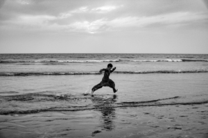
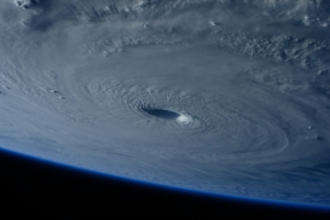
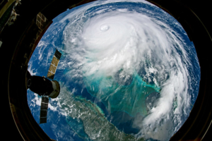
Countries in the Asia-Pacific are among the most vulnerable to tsunami hazards. The region accounts for a significant portion of the Ring of Fire, a string of coastal countries along the Pacific Ocean where nearly 80% of all tsunamis occur. Asian-Pacific nations also have a significant number of coastal communities, including some of the world’s largest megacities. This high level of coastal residence puts millions at risk, evident in the fact that the region accounts for 99% of global tsunami deaths. To reduce fatalities and enhance tsunami readiness in the Asia-Pacific, many affected countries are taking unified action. Central to this effort is increasing the resilience of school communities to these threats.

The Regional Tsunami Project

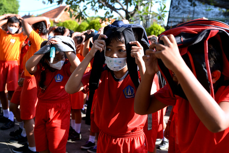
Responding to a widespread need, the United Nations Development Programme (UNDP) and the Government of Japan created a joint initiative to help countries across the Asia-Pacific enhance their tsunami preparation. The Regional Tsunami Project works with governments, schools and communities to develop locally adapted plans of action to address tsunami risk. More than 800 schools across 24 Asia-Pacific countries are involved, integrating tsunami education and evacuation drills into their curricula.

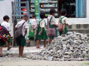
Evacuation drills give community members the knowledge and tools they need to take quick action in the face of danger. It is especially important for schools to participate in regular drills, as children remain highly vulnerable to disasters. The project’s guidebook, Regional Guide for Schools to Prepare for Tsunamis, provides actionable steps for administrators and educators to enhance planning and implement safety curricula. Widely adopted practices include educating students on how to identify tsunami hazards, using the phrase “Feel. See. Hear. Run.” as a guiding technique. During evacuation drills, students learn where their nearest safe zones are and practice moving from classrooms to these areas.

The Use of Digital Tools

Technology is changing the way communities advance tsunami readiness in the Asia-Pacific. In fact, within school administration and disaster planning, digital tools have become essential. One tool developed by the Regional Tsunami Project is STEP-A (Strengthening Tsunami and Earthquake Preparedness Assessment), an online platform used in Indonesian schools.

STEP-A helps schools determine their tsunami preparedness through self-assessment, engaging students, educators and administrators. Once preparedness levels are identified, the application provides recommended steps for improvement. School readiness information across Indonesia is then integrated into InaRISK, the national disaster-monitoring tool, which provides real-time information on community hazards.

Schools are also adopting other innovative digital tools. In Samoa, students use virtual reality headsets that simulate what their surroundings may look like during a tsunami. This technology helps younger students, many of whom have never experienced a natural disaster, visualize evacuation routes and understand flood scenarios.  Research shows that immersive exercises improve knowledge retention and help students feel more confident in their ability to respond quickly during an emergency.

A Safer Future for the Asia-Pacific

The Regional Tsunami Project has laid a strong foundation for natural disaster resilience and tsunami readiness in the Asia-Pacific, especially in schools where preparation is essential to keeping younger generations safe. Digital tools will continue to play an important role, strengthening cooperation and enhancing preparedness among communities. Tsunamis will remain a serious threat in the region; however, by building the capacity to respond effectively, the Asia-Pacific can move toward a safer and more resilient future.

– Quinlan Bohannon

Quinlan is based in Portland, OR, USA and focuses on Technology and Solutions for The Borgen Project.

Photo: Flickr

Recovering From the Punjab FloodsIn September 2025, states in northern India faced heavy rains, flash floods and overflowing rivers. Entire villages and thousands of hectares of farmland were submerged. About 35% of Punjab’s population works in agriculture and they experienced the region’s worst flooding in four decades, severely disrupting livelihoods. The Punjab floods caused at least 51 deaths and more than 400,000 people were forced to flee.

Additionally, hundreds of thousands of Punjabis were left without electricity or clean water. Even before the floods, Indian farmers were facing increasing hardships. Many had accumulated high debts while struggling with low incomes and heavy crop losses due to the climate crisis, which has created extreme weather conditions that defy predictability and planning.

The recent flooding has worsened these challenges, leaving many farmers with nothing left. Observers on the ground have stated that for many farmers, recovering from the Punjab floods is proving extremely difficult. 

The Good News

The good news is that financial assistance has been provided to help farmers rebuild their lives. By the end of September 2025, the Punjab government—led by the Aam Aadmi Party (the Common Man Party)—announced a 20,000-rupee ($230) allowance for farmers who lost their crops to the floods. In addition, relief efforts have come from all directions, including Non-Resident Indians, global Sikh charities and local volunteers.

Pritpal Singh of Hanspal Traders in Kapurthala built more than 100 boats and distributed them free of charge to support rescue operations. Buffalo and cattle have also been purchased for dairy farmers who lost their animals in the floods. The charity Khalsa Aid rescued stranded families and livestock and provided clean drinking water, ration bags and medical assistance.

Khalsa Aid also deployed specialized de-watering systems that have already dried more than 1,000 acres of waterlogged land. The organization’s team is also working directly with farmers in the Abohar area to help them restore their fields and resume cultivation. This support has become a lifeline for many whose livelihoods were severely threatened by the floods.

Recovering From the Punjab Floods

There is a prolonged economic challenge ahead for farmers, as they require considerable investment to recover from the floods. Climate instability is hitting developing countries the hardest, with some of the most financially vulnerable people in the world being affected. Punjabi farmers have already been living in precarious conditions and extreme weather conditions have exacerbated their problems.

However, the relief efforts for the Punjab floods have demonstrated that the Asian diaspora can collaborate with local volunteers in India to assist farmers and communities in rebuilding their lives. The response has been a large, well-coordinated effort involving multiple countries, diverse groups and both governmental and nongovernmental bodies. Agriculture is widely recognized as crucial to Punjab and it is clear that farmers operate with limited resources.

This reality has driven everyone involved in the relief work to sustain their efforts and support long-term recovery.

– Suneel Mehmi

Suneel is based in the United Kingdom and focuses on Good News for The Borgen Project.

Photo: Flickr

Caribbean Resilience after Natural Disasters
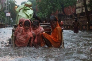
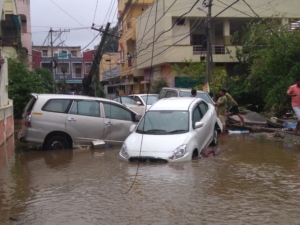
Caribbean islands are frequently witnessing hurricanes, floods, droughts, earthquakes and landslides. On October 28, Jamaica witnessed its first Category 5 hurricane, Hurricane Melissa, which brought devastating storm surge, flash flooding and landslides across Jamaica and nearby islands. The rapid intensification of the hurricane caused an estimated damage of more than $48 billion across Jamaica, Cuba, and The Bahamas and 75 total deaths in Jamaica and Haiti.

The widespread devastation consisted of roofs torn off, mudslides, and flooded farmland. Also, 70% of the population lost electricity. In response, local authorities issued nationwide red alerts and opened 800 emergency shelters. The Red Cross mobilized volunteers for evacuations, relief distribution, and reinforcing warnings. This is how sustainable rebuilding and early-action systems are transforming the Caribbean resilience after natural disasters.

Context and Vulnerability of the Caribbean Islands

Local communities frequently struggle with natural disasters since seven out of every 10 natural events in the Caribbean are storms or floods.

After the catastrophic damages of Hurricanes Irma and Maria in 2017, the Caribbean region developed stronger regional cooperation and investment in disaster preparedness and infrastructure resilience. Initiatives like the Caribbean Regional Resilience Building Facility (CRRBF) joined by the European Union, GFDRR, and the World Bank, work to improve long-term disaster resilience and adaptation capacity for vulnerable areas of the region. Key national and regional strategies include strengthening early warning systems, investing in modern weather forecasting and building resilient infrastructure.

In the context of Caribbean countries facing natural disasters, vulnerable populations are the most affected. As of 2025, one in four people live in poverty in these regions and 37% of the population is moderately/severely food insecure. Food insecurity comes from a high cost of food and the majority of it being imported. Moreover, Caribbean economies are small and tourism-dependent and their energy costs are among the highest globally.

Also, post-disaster recovery often leads to debt and internal displacement of communities. For instance, 10 million people faced displacement from 2008 to 2023 due to natural disasters. In addition, climate damages could rise from 5% of regional GDP in 2025 to more than 20% by 2100.

Many studies and reports have shown that to strengthen the economic well-being of Caribbean communities it is vital to assist policymakers and development partners in planning for climate resilience, promoting economic diversification, and facilitating access to financing.

Jamaica

Good examples of Caribbean resilience after natural disasters are the Community-Based Disaster Preparedness partnered with UNICEF and ODPEM, the Office of Disaster Preparedness and Emergency Management. Following Hurricane Beryl in 2024 these programs distributed 400 (water, sanitation and hygiene) WASH Shelter Kits to emergency shelters with a value of J$14.8 million.

Specifically, the ODPEM represents the national disaster management authority and was formed in July 1980, following major floods in 1979. The institution incorporates community resilience, educational initiatives, and policy reforms within national disaster risk reduction strategies.

The UNDP also supports risk-informed development and improves disaster governance by encouraging community-level engagement.

Dominica

In 2017, Hurricane Maria destroyed 90% of Dominica’s housing, demolishing 4,500 homes  and damaging more than 20,000 properties.

Consequently, the World Bank funded a $40 million house recovery project Build Back Better Housing Project in the island. It established a Management Information System to manage nationwide housing recovery data and delivered practical training on resilient building techniques to local contractors and government staff.

The program also rebuilt 676 small homes and donated financial grants and technical assistance to homeowners.

Haiti

A significant example of community resilience happened in Haiti following the 2010 earthquake that caused massive destruction. The local communities worked on rebuilding roads, homes, and public facilities. For instance, the construction of almost 600 classrooms created local employment.

Haitian institutions and citizens joined forces in the development of housing and infrastructure. They managed to achieve sustainable recovery by involving civil society organizations and local communities in decision-making and providing training and employment for the reconstruction process. The Red Cross Red Crescent also partnered with the Haitian Red Cross to provide improved shelters to more than 44,000 households.

As a result, local leadership and national ownership created more than 300,000 jobs, providing training to 2,700 Haitian professionals. Most importantly, 2,000 metres of gabion walls were constructed for disaster risk reduction.

The Impact of Caribbean Resilience after Natural Disasters

The Caribbean islands have seen 24 million people feel the impacts of natural disasters in the last 40 years and an 85% increase in extreme weather events. However, the World Bank and the U.N., as well as local initiatives, have been funding projects that integrate long-term resilience into recovery.

The centre of these projects involves education, capacity building, and institutional strengthening to achieve long-term resilience. As a result, Caribbean islands are not only recovering but also building back stronger than ever.

– Angela D’Avino

Angela is based in Preston, UK and focuses on Good News and Global Health for The Borgen Project.

Photo: Flickr

Amazon's disaster relief hubsThe world is currently in the midst of hurricane season and Hurricane Melissa, a category five storm, hit the island of Jamaica hard. Hurricane Mellisa has killed many people and displaced many more. However, some major corporations have contributed to the Hurricane Melissa relief efforts. Here’s a look at the impact Hurricane Melissa has had on Jamaica, as well as some of the relief efforts underway in response to it.

Hurricane Melissa’s Impact

A recent NBC News report stated that Hurricane Melissa killed 32 people in Jamaica and described it as the most devastating storm ever to make landfall in the country. The British Red Cross also noted that more than 30,000 Jamaicans have been displaced, with the number rising daily. Hurricane Melissa’s financial toll is also being felt throughout Jamaica.

According to a recent report by Reuters, the storm could cost Jamaica as much as $7 billion, a conservative estimate. Experts say that all totaled, Hurricane Mellisa could cause a 30% drop in Jamaica’s GDP, severely weakening its economy.

How Amazon Is Helping

In 2021, Amazon opened its first disaster relief hub in Atlanta, Georgia. It subsequently built 14 additional disaster relief hubs, strategically placed in areas prone to disasters, to assist with a variety of natural disasters. According to WSB-TV Atlanta, the Amazon disaster relief hub in the city is sending emergency supplies to Jamaica. These include a range of portable technology solutions designed to power and connect hospitals, police stations and emergency operations in Jamaica.

The hub can deploy up to 1.4 million pre-packaged relief items within 72 hours of a natural disaster. According to Amazon’s website, its disaster relief hubs are stocked with muck and gut kits to help with flooding, hygiene kits to keep people clean and sensory kits to help children who may be overwhelmed by staying in shelters. These kits provide them with noise-canceling headphones, a weighted blanket and toys.

The WSB-TV Atlanta report also notes that since launching in 2021, Amazon’s disaster relief hubs have supported more than 190 disaster zones. Additionally, they have delivered more than 26 million relief items.

Conclusion

Hurricane Melissa has had a devastating impact on Jamaica — one that will be felt for years to come. However, relief efforts from Amazon’s disaster relief hubs, as well as collaboration with a host of nonprofits, are expected to strengthen recovery efforts. Furthermore, efforts will help to ensure that displaced residents have homes to return to.

– Charlie Means

Charlie is based in Denver, CO, USA and focuses on Good News and Technology for The Borgen Project.

Photo: Pixabay

Being Poor in JamaicaIn the wake of a monstrous category 5 storm making its way to the shores of Jamaica, a growing 11,000 hashtags of support, #PrayForJamaica, have flooded Instagram, turning awareness into action around the world. As the people from the land of wood and water begin the long road to recovery from one of the strongest hurricanes to strike the island in the 21st century, a more vulnerable population on the island falls prey to the storm’s devastating aftermath. Being poor in Jamaica during the recovery of Hurricane Melissa extends beyond poverty measured by income, revealing deep-seated inequalities in health care, education and basic living conditions that the hurricane has exposed in its wake.

The Extensive Damage of Hurricane Melissa

When a category five hurricane washes up on a country’s shore, it does not just arrive with its share of catastrophic rains and howling winds. Instead, the insatiable storm consumes everything in its path, including the lives of families, homes and communities forced to rebuild from the wreckage. After one of the worst natural disasters to hit Jamaica, the Caribbean island looks a lot different from before the devastating storm took its toll on the coastal region. What once was a tropical paradise celebrated for its divine beauty and vibrant culture now sits underwater, stagnant in the remains of one of the strongest hurricanes to strike the island in the 21st century.

With at least 32 reported lives lost on the island, and estimated catastrophic loss between $2.2 billion and $4.2 billion USD in damages, entire communities have been demolished, leaving many families without a place to call home.

Jamaican influencer One Love Jamaica took to his YouTube channel to document Hurricane Melissa’s catastrophic damage across the island. Departing from his usual content of giving viewers a taste of Jamaican culture, food and music, the man behind One Love Jamaica spoke to his more than 19,000 followers with a new message. In a Skyview camera-mounted video peering over one of the most affected regions on Jamaica’s southern coast, St. Elizabeth’s parish, the native-born creator narrates, “Many residents here are trapped inside their own communities, watching the world behind a wall of water they cannot cross,” solemnly adding that, “People are waking up every day to uncertainty, unsure of what the future holds for a place they call home.” This storm has left an unimaginable loss throughout the community, however, even in the midst of the chaos, hope persists for brighter days ahead.

Being Poor in Jamaica

Even before the storm struck, Jamaica faced economic instability with a global poverty report revealing that nearly 79,000 Jamaicans, which is about 2.8% of the population, were already living in multidimensional poverty, surviving on less than $3 USD a day.” Hurdles to necessities have only intensified with Hurricane Melissa, making poverty and natural disasters an entangled issue for those struggling to stay afloat under its weight.

Speaking with a resident of St. Elizabeth, One Love Jamaica provided insight into the personal struggles facing impoverished islanders. Against the background of the storm’s devastation, resident Ann-Marie McDonald-Samon shares her story with the audience: “During this storm, my house has been damaged, the roof is gone, and the clothing. I am asking Jamaica, or those who have not been affected by the storm, if they can send some assistance to us.” As the camera pans across the community, it is evident that Ann-Marie’s struggle is not one she bears alone. With friends, family and the neighbors standing together in the wreckage of the havoc that has knocked at each door.

The Global Empowerment Mission (GEM)

Answering to a community’s prayer, Jamaica has leaned on communities beyond its borders in its recovery efforts. Relief Missions for the region began almost immediately in the aftermath of the storm, making sure to cover all those impacted by the rage of Melissa. This includes support across the impacted Caribbean islands from organizations such as Global Empowerment Mission (GEM), which has committed more than $20 million in aid for Jamaica. This has translated to a staggering 500 metric tons of aid per week, including 18 cargo planes and containers of food, and two cruise ships carrying emergency aid to the island’s shores.

International Aid

Coordinated efforts from international partners have also stepped in including the United States, which has donated $37 million since November 12th, Canada, which has provided $11 million with an additional $6 million for disaster preparedness and recovery, and the United Kingdom, which has contributed $9.8 million in total relief. These combined efforts from some of the world’s most influential governments and nonprofits have ensured all hands are on deck to contribute to the community’s cry’s for need are not unmet. 

The Results of #PrayforJamaica

While helping hands have stretched across the island, ripples of compassion have extended to likes and shares online. In recent weeks, social media users have taken to their platforms to show their support for recovery efforts following the island’s devastating loss. Through the power of #PrayforJamaica, users have mobilized their collective relief efforts, sharing prayers, donation links and additional information to help those who the storm’s devastation most affected. 

Digital solidarity has contributed to people making donations towards nonprofit agencies such as Mercy Corps, Food For The Poor Jamaica and American Friends of Jamaica ( AFJ).​​ These organizations have used the flood of monetary donations to contribute to the community’s dire needs to repair infrastructure, rebuild homes, restore power and clean water and provide sanctuary for displaced individuals as they navigate loss. 

Being poor in Jamaica requires more than temporary means of aid but long-term investments that ensure they remain on their feet. These initiatives are true recovery efforts that ensure stability and last beyond a hurricane.

A Lasting Message of Unity

In his video, “St.Elizabeth is Drowning After Hurricanes,” One Love Jamaica centers on the lives that the passage of Hurricane Melissa touched. A video that has garnered more than 210,000 views has introduced an online platform on the natural disasters that impact real people. It captures roads that have halted the traveling of cars, communities unable to travel by foot over the land surrounded by water, and many other personal stories like Ann-Marie, where every dollar and share makes a difference in their daily lives. 

With sky view footage, One Love Jamaica reminds viewers of the persistent resilience of the Jamaican people. Ending the video with a lasting message of unity that no storm could drown, he said that “People are offering strength to each other in the darkest of moments –  this is the Jamaican spirit.” 

One Love Jamaica’s inspirational message embodies the resilient spirit in his home country and across digital borders. In the wake of a ravenous storm that has torn through hospitals, churches, schools and homes, poor Jamaicans are able to keep hope of a prosperous future as they continue to rebuild with strength with the little they have.

– Megan Omolo

Megan is based in Willingboro, NJ, USA and focuses on Celebs and Politics for The Borgen Project.

Photo: Unsplash

Seismograph TechnologyAccording to data measurements from the Nay Pyi Taw Seismological Observatory in the Philippines, the tropical storm typhoon Bualoi, which occurred in the West Pacific Ocean during September 2025, measured a strong 6.9 on the Richter scale. Typhoon Bualoi brought heavy rainfall, flooding and landslides that caused extensive damage to roads, buildings and bridges, along with power outages and numerous casualties in Vietnam, Laos and Thailand. In Vietnam, 30,000 people were evacuated ahead of the storm. Poverty rates remain high across Southeast Asia, where these three countries are located.

Tropical storms, such as Typhoon Bualoi, form over warm tropical oceans. When they intensify, they are classified as hurricanes, cyclones or typhoons, depending on the region in which they occur.

Typhoon Bualoi’s Impact on Vietnam’s Poverty and Infrastructure

According to Sky News reports, Typhoon Bualoi caused extensive flooding and landslides in Vietnam. Consequently, the town infrastructure of Vietnam became disarrayed, leading to the disconnection of roads and regional areas in the northern mountains of Son La and Lao Cai provinces, as well as central Nghe. Excessively high levels of water rose in the Thao River of Yei Bai to emergency levels, causing floods to overflow into residents’ houses.

Other news report stations have revealed that more than 200,000 homes, cities and farmland were destroyed by the typhoon, amounting to an approximate maximum of $600 million in damages. Tropical storms heighten and accelerate poverty due to the extensive cost of infrastructural repairs and disruption of town services. Poverty markers from the charity Oxfam indicate that 13 million people in Vietnam live in poverty.

Typhoon Bualoi also disrupted several transport networks: Vietnam’s Noi Bai International Airport had to suspend operations to ensure safety during the storm and Vietnam Railways Corporation canceled most services between Hanoi and the business hub of Ho Chi Minh City. Climate instability may have further worsened the storm’s impact, as rising global temperatures melt ice caps, raise sea levels and increase the likelihood of natural disasters.

Seismograph Technology Solutions 

The seismograph at the Filipino Nay Pyi Taw Seismological Observatory records ground oscillations caused by seismic waves from earthquakes, volcanic eruptions and certain microseisms from storms at sea. Seismographs are built with electromagnetic sensor components that convert ground movement into electrical signals, which are recorded and processed by digital or analog circuitry. They can be calibrated to measure earthquake magnitude quantitatively, using scales such as the Richter scale.

Tropical storms, such as Typhoon Bualoi, leave detectable signatures in seismic data, as ocean waves generated by strong winds produce signals known as seismic fingerprints. Seismograph technology helps evaluate and assess these microseisms from typhoons, enabling authorities to implement effective evacuation plans and relief efforts according to the storm’s severity. More effective evacuation plans and a durable disaster risk management strategy, especially during the monsoon season, are crucial in reducing the widespread poverty caused by tropical storms.

Seismograph technology proved instrumental during Typhoon Bualoi, supporting the execution of evacuation protocols and the delivery of charitable aid to affected regions.

Innovative Seismograph Technology

Innovative seismograph technology has been developed for the enhanced detection of smaller, lighter and more types of seismic waves. The innovative technology employed mathematical research techniques in the field of polarization analysis, which involved studying the motion of particles in three dimensions to detect a wide range of polarized seismic waveforms. Such research has been pivotal in evaluating seismic waves from underground locations with minimal observation points.

The novel seismograph technology enhances the detection of earthquake seismic waves, facilitating the construction of more effective natural disaster risk assessments, as well as short-term and long-term preparedness for tropical storms. Building natural disaster shelters, implementing evacuation strategies and preparing for domestic flights, as well as irrigation dams and inland water transport, are all aspects of tropical storm preparedness.

Charity Response to Typhoon Bualoi

The charity ShelterBox supports relief efforts in regions affected by Bualoi through emergency shelters, solar lights, mosquito nets and blankets. The Samaritan’s Purse charity also provided aid to support the effects of the typhoon by distributing relief kits. It included food kits, cooking pots, mosquito nets, blankets and personal hygiene kits containing towels, soap and dental products, which were distributed to hundreds of families in Ha Tinh Province, Vietnam.

Seismograph technology has been an instrumental solution, alongside other charitable outreach efforts, in alleviating poverty caused by tropical storms. By evaluating seismic waves, it facilitates more effective evacuation protocols and disaster preparedness.

– Deborah Asante

Deborah is based in London, UK and focuses on Technology and Global Health for The Borgen Project.

Photo: Flickr

Tackling Geographical Poverty in Nepal Nepal, a landlocked country nestled in the Himalayan mountains, is one of the poorest countries in South Asia. In 2022, the national poverty rate stood at 20.3%. While this is a significant improvement from 68% in 1996, social and regional disparities mean that rural communities across Nepal experience a slower decline or even an increase in poverty compared to urban centers. As of 2024, more than 77% of Nepalis live in rural areas, making poverty alleviation an urgent and ongoing challenge.

One key factor behind Nepal’s enduring poverty is its geography. The country’s mountainous terrain, landlocked position and susceptibility to frequent earthquakes all make infrastructure development and economic growth difficult. This article explores how geographical barriers contribute to poverty in Nepal and highlights efforts underway to overcome them.

Inaccessible and Deadly Terrain

Nepal’s rugged mountains, steep hills and deep valleys make building and maintaining infrastructure, such as roads and electricity, challenging, particularly in remote regions. Heavy monsoon rains, floods and landslides frequently damage roads and homes, leaving many areas isolated for long periods. Many rural communities lack the financial resources to repair these damages. By 2012, more than half of Nepal’s roads built over the previous 15 years had become unusable due to poor maintenance.

Limited infrastructure also affects digital access. In 2022, the United Nations Children’s Fund (UNICEF) reported that only 3% of Nepali youth had access to computers and the internet, largely because of inadequate connectivity. This severely limits online education and remote work opportunities, particularly when travel becomes difficult or dangerous.

As a result, access to basic goods, employment opportunities and education is often time-consuming, costly, hazardous and unreliable. In Nepal, at least 90% of passenger and freight movement is done by road, which imposes heavy burdens on the poor and hinders long-term economic growth in rural areas. 

Paving New Roads: The Rural Access Program Nepal

Between 2017 and 2023, the Rural Access Programme Nepal built more than 1,100 kilometres of road and improved access to markets, health and education facilities for more than 2.75 million people in rural areas. Beyond building and maintaining roads, the project trained more than 40,000 people in new income-generating skills and created at least 19 million days of employment, 40% of which were women. 

This program marks a crucial step toward enchanting mobility, promoting gender inclusion, and reducing poverty in Nepal. The program is set to continue through 2025, further expanding its impact on rural connectivity and livelihoods. 

Expanding Digital Connectivity

In early 2025, FC, Standard Chartered Bank Nepal Limited, and WorldLink Communications Ltd. partnered on a $29 million project to expand Nepal’s fiber networks and develop innovative, environmentally sustainable data centers. The initiative aims to bridge Nepal’s digital divide and promote inclusive economic and educational development.

WorldLink, Nepal’s leading internet provider, has already built a nationwide fiber network spanning more than 7,500 locations, including remote and underserved areas. Improved internet access has opened new avenues for education, job creation and entrepreneurship, and has helped to reduce regional disparities and support long-term economic growth.

Barriers to Trade

Nepal is landlocked between China and India, with no direct access to the sea. As a result, the country relies heavily on India for most of its international trade, making imports and exports both costly and time-consuming. Historically, the country has also experienced several trade disruptions and blockades along its border with India, which have further contributed to persistent poverty in Nepal.

Railways for Connection

Despite these challenges, Nepal has significant potential to boost trade and development by enhancing cross-border connectivity with its powerful and wealthy neighbors, China and India. Proposed railway projects linking Kathmandu with Keyrong (China) and Birgunj (India) will enhance trade, diversify the economy, reduce reliance on remittances and create jobs for millions of Nepalis. Moreover, by designing these railways to be sustainable and climate-resilient, Nepal could attract investment from global institutions such as the World Bank and the United Nations (U.N.) to fund these projects.

Destructive and Deadly Earthquakes

Nepal sits on the active boundary between the massive Indo-Australian and Asian tectonic plates. The ongoing collision of these massive plates causes frequent and powerful earthquakes, which destroy homes and infrastructure and injure thousands of people. These disasters are extremely costly and hinder stable economic growth, particularly in rural areas where resources for recovery are limited.

Seismic Resilient Infrastructure

Projects like the SAFER Project are working to develop earthquake-resilient infrastructure that increases human safety and reduces damage from seismic activity. The SAFER Project specifically aims to improve the seismic safety and resilience of schools and community buildings in Nepal through collaborations with rural communities, international researchers, developers, nonprofits and the Nepali government. 

Techniques like base isolation, which decouple buildings from the ground, help structures remain stable during earthquakes by allowing the ground to move independently. SAFER also uses affordable, locally available materials like stone instead of costly concrete to make earthquake-resistant construction more achievable for rural communities. 

By protecting schools and public facilities, initiatives like SAFER can help maintain school attendance and job security for teachers following natural disasters, supporting long-term community stability and development.

Overcoming Geographical Poverty in Nepal

From its rugged terrain and isolation to its landlocked trade barriers and seismic risks, Nepal’s geography poses numerous formidable challenges when it comes to poverty alleviation. Yet, the nation’s ongoing investments in infrastructure, connectivity and resilience offer hope to both Nepalis and other countries facing similar issues.

– Dylan Kretchmar

Dylan is based in Granville, OH USA and focuses on Good News and Technology for The Borgen Project.

Photo: Flickr

U.K. aid in Myanmar
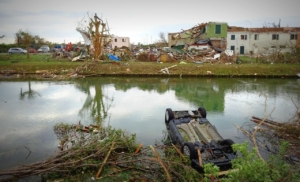
U.K. aid in Myanmar has risen rapidly since the earthquake of March 2025 and has taken a variety of forms. Different charities have focused on different geographical and societal groups, and have operated with different levels of government involvement.

The Situation in Myanmar

The U.K. has devoted more than £100 million of aid to Myanmar since 2017, according to a statement from Parliamentary Undersecretary in the Foreign, Commonwealth, and Development Office Seema Malhotra. Rakhine state alone received £108 million on the country’s western coast, which has been involved in a conflict since a military coup in Myanmar in 2021.

Almost half of this aid went towards helping the Rohingya people, and other Muslim groups who have faced persecution by the military government. With Malhotra claiming this aid has reached 1.3 million people since 2022. The earthquake has worsened the political turmoil in Myanmar in March 2025.

In response to this, the U.K.’s Disasters Emergency Committee (DEC), a coalition of charities that the U.K. government supports through the aid match scheme, launched a specific appeal designed to rapidly increase U.K. aid in Myanmar.

Myanmar’s military government blocking aid to areas outside of military control has allegedly hampered this scheme, according to the U.K. governemnt. This raises questions over how U.K. aid in Myanmar can be more effective.

About the DEC

The DEC comprises 15 leading U.K. aid charities that collectively raise funds rapidly during overseas crises. This coalition intends to combine the different charities’ resources in order to reduce administrative costs and distribute U.K. aid in Myanmar and around the world as efficiently as possible.

The U.K. government’s aid match scheme supports the group, whereby the government donates an amount equal to that donated by the public for any given appeal.

Aid match has previously helped raise £50 million for the 2021 Afghanistan Crisis Appeal, and is currently also fundraising for aid schemes in Ukraine and Pakistan.

While aid match has previously been successful, there are fears that closely associating aid efforts with the U.K. government could lead to them being refuted by foreign governments, as is allegedly the case in Myanmar.

ActionAid

The charity ActionAid is a member of the DEC and has been active in Myanmar since 2001.

ActionAid’s primary focuses include defending women’s rights in Myanmar, through schemes that train police officers to enforce laws designed to prevent human trafficking and child marriage.

Earthquake damaged Myanmar’s agricultural sector, disrupting trading networks and destroyed farmland.

ActionAid have attempted to assist in Myanmar’s economic recovery by training women in the worst-affected regions to set up their own small businesses. The blocking of aid to regions outside of direct military control has slowed this process, potentially leaving women in these regions at risk of exploitation.

Independent Aid: Health and Hope

Health and Hope is an independent U.K. charity that works to help those living in Chin state, the poorest state in Myanmar.

Around 73% of people living in the Chin state are not able to meet their basic food needs, compared to 32% of the country as a whole.

Despite not contributing as much funding towards U.K. aid in Myanmar as some of its counterparts in the DEC; Health and Hope has helped train 329 Community Health Workers over the past year.

Health and Hope has, in fact, deliberately maintained as small a workforce as possible to deliver as large a proportion of donations as possible directly to its aid projects in Myanmar. The charity estimates that 88% of all external funding goes directly to aid projects. Their small size has also made Health and Hope less of a target for military blockades, that have prevented larger aid organisations from entering certain regions of Myanmar.

The Government’s Future Role

U.K. aid match has undoubtedly played a vital role in fundraising for various aid projects throughout the last decade, including in Myanmar. This scheme, combined with the public recognition of, and trust in, the DEC and its members, have helped to maximise the value of the aid assigned to Myanmar since the earthquake of March 2025.

– Billy Stack

Billy is based in London, UK and focuses on Global Health, Politics for The Borgen Project.

Photo: Wikimedia Commons

Gilgit Baltistan FloodsFrom June to September 2025, Pakistan experienced one of the deadliest floods in its history. More than 1,000 people lost their lives, 274 of them children. On July 13, 2025, a cloudburst occurred in Gilgit Baltistan, followed by floods that isolated villages and blocked key highways.

The Borgen Project spoke with a 20-year-old girl, Eman Khan from Ghizer, who experienced firsthand the devastating impact of the floods, including the loss of essential family documents.

Warning Signs and Immediate Reactions

A cloudburst triggered the Gilgit Baltistan Floods of July 13. According to the Gilgit-Baltistan Disaster Management Authority, the floods damaged 13 houses, destroyed farmland and washed away irrigation channels. The floods also blocked the Gilgit–Ghizer Highway and isolated communities.

Khan told The Borgen Project that the day began with no major warning signs. The clouds, however, seemed unusually dark and the heavy and intense rain turned into a cloudburst within minutes. According to Khan, while Gilgit experiences seasonal floods, this cloudburst’s sheer force and speed were unlike anything she had witnessed before.

After the cloudburst, the first instinct, she recalled, was to rush outside, gather the family in one safe spot, call the children and move to higher ground as quickly as possible.

Khan said her family stayed calm during the crisis and avoided the river. They then took shelter at a relative’s house, which was built on slightly higher land. Khan added that the neighbors were also very helpful, shouting warnings to each other, helping evacuate children and older adults and sharing food and blankets with families that had to leave their homes.

Damage, Loss and Recovery

Khan told The Borgen Project that the Gilgit Baltistan Floods occurred in a sequence of a cloudburst followed by subsequent floods. The Gilgit Baltistan floods partially destroyed homes, washed away fields of crops, blocked roads and swept electricity poles into the water.

She added that her family lost some household belongings and important family documents. Other villagers lost livestock and stored food they depended on. Despite devastation, Khan said the community showed strong unity and support; people opened their homes to those displaced, cooked meals together and organized local volunteers to clear debris.

In the aftermath of the Gilgit Baltistan Floods, NGOs and local administration sent emergency relief, including food supplies, tents and medical aid. Volunteers from youth groups also played a vital role in rescue and relief work.

Impacts and Future Prospects

Khan shared that the Gilgit Baltistan Floods made her realize how vulnerable her family is in front of the forces of nature. She now recognizes the importance of preparedness and deeply respects the environment.

In the future, she hopes for better adaptive strategies in disaster-prone areas, including early warning systems, flood defences, stronger infrastructure and long-term support for rebuilding livelihoods. Above all, she hopes for a future where children are safe when disasters strike.

– Sidra Tahir

Sidra is based in Rawalpindi, Pakistan and focuses on Technology and Politics for The Borgen Project.

Photo: Pexels

FloodWatch India 2.0India’s rich diversity and vast landscape have long been admired. However, every monsoon season leaves behind a trail of devastation, damaged roads, displaced communities, lost lives and billions of rupees in property damage. Out of the country’s 329 million hectares of geographical area, 40 million hectares are flood-prone, particularly across the Indo-Gangetic-Brahmaputra plains. In the past decade alone, India has suffered damages worth approximately $540 million.

To address these recurring challenges, the National Disaster Management Authority (NDMA) has turned to technology. The government’s tech-driven fight against floods in India using apps, mapping and smarter alerts represents a shift toward proactive preparedness and citizen-focused safety measures.

FloodWatch India 2.0: Real-Time Alerts at Scale

In the wake of the frequent floods, the government of India launched a revolutionary real-time flood alert app, FloodWatch India 2.0. The key features of the app are as follows:

  • Real-Time Forecasting
    • The app gives live updates from 592 monitoring stations, a big jump from the earlier 200.
    • These stations track rainfall, river levels and water flow, which helps generate accurate flood forecasts.
  • Reservoir Tracking
    • It monitors the storage levels of 150 major reservoirs across India.
    • Since these reservoirs are critical for drinking water, irrigation and power, this feature helps people anticipate risks of overflow and downstream flooding.
  • Advanced Flood Information
    • One of the standout features is its ability to predict the likely extent of submergence in flood-prone areas.
    • This gives citizens time to plan evacuations or take protective measures.
  • Comprehensive Coverage
    • The forecasts extend to regions downstream of the 150 nationally monitored reservoirs.
    • This ensures wider protection for vulnerable communities.
  • Technology & Working
    • Uses satellite data to analyse rainfall patterns, river conditions and other flood indicators.
    • Employs advanced mathematical models that combine real-time data, weather forecasts and historical trends.

GIS and Remote Sensing in Flood Risk Assessment

Geographic Information System (GIS) and remote sensing are widely used for identifying flood risk and vulnerability, as they allow the integration of digital elevation models, soil maps and historical rainfall data into regional development planning. These tools support pre-flood assessments, detection of prior floods and land use and land cover classification.

Flood risk maps are often created using compound hazard and vulnerability indices together with methods like the Analytical Hierarchy Process (AHP), which highlight high-risk zones such as in the Gangetic basin and flood-prone areas of Assam. Such approaches show that remote sensing and GIS are effective in minimizing runoff, supporting rainwater harvesting and preparing communities for potential disasters.

Advanced techniques are also being applied to improve accuracy and coverage. Remote sensing has been combined with clustering algorithms and multi-temporal satellite data to identify flood hotspots across south Asia, while integrated systems using machine learning with AHP generate detailed hazard maps that reflect varying vulnerability levels.

In urban areas, GIS and field surveys are applied to address drainage challenges, such as those along the Yamuna in Delhi. Other methods include using drainage density, slope and land use data to estimate flood risk or analysing time-series satellite images in data-deficient regions. Some approaches also incorporate community perception and mitigation measures into risk assessment, offering a more holistic understanding of hazards and ensuring that flood management strategies are both data-driven and socially responsive.

Floods, Food Security and Poverty in India

Floods are not only a humanitarian crisis but also a threat to economic and food security. Between 1900 and 2020, the country faced more than 300 floods that displaced 30 million people annually and caused more than 1,500 deaths each year. The 2013 Uttarakhand floods alone claimed more than 6,000 lives and caused losses exceeding $3.8 billion.

Such events disrupt food production, storage, access and utilization, directly undermining food security. This vulnerability feeds into poverty cycles, as families lose both food and income when crops, livestock and livelihoods are destroyed. Rural areas, with fragile housing and limited infrastructure, face prolonged recovery, while cities like Delhi and Chennai struggle with dense populations and inadequate drainage.

Weak early warning systems worsen the toll. Addressing these challenges requires resilient infrastructure—stronger drainage networks, flood barriers and durable housing—that can reduce damage and speed recovery. By breaking the cycle of flooding, hunger and poverty, India can strengthen long-term resilience.

A Technology-Backed Future

India’s reliance on technology, for example, FloodWatch India 2.0, demonstrates a clear evolution in disaster management. The integration of tech-driven fight against floods highlights not just preparedness but also resilience. As climate instability intensifies extreme weather, these innovations will play a critical role in safeguarding communities, reducing economic losses and ensuring a more secure future.

– Chhahat Kaur Gandhi

Chhahat is in New Delhi, India and focuses on Business and New Markets for The Borgen Project.

Photo: Wikimedia Commons