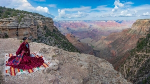
Indigenous communities all around the world have been facing the destruction of their lands as populations grow. Land shortages have only increased as changing climate continues to make parts of the world uninhabitable. The expansion of urban construction into protected Indigenous lands has violated the rights of Indigenous communities, who often have formal legal agreements with surrounding governments. Additionally, Indigenous people typically have poorer health and development outcomes than their non-Indigenous counterparts. The use of drones for land mapping is giving Indigenous communities more power and protection. Here is some information about Indigenous land mapping.
Indigenous Land Mapping
Creating accurate and culturally sensitive maps gives Indigenous communities respect and anchors them in their traditions. While there is a long history of erasure within Indigenous lands, mapping legitimizes their claims in the eyes of surrounding governments. This is particularly important when it comes to the preservation of this land, as well as the livelihoods of the Indigenous peoples who inhabit it.
The Indigenous Mapping Collective is a virtual network of Indigenous people who empower each other to map their communities. It offers skills training in drone use, land mapping and more from professional cartographers. In 2014, the Indigenous Mapping Collective partnered with Google Earth and held its first workshop designed to encourage more representation on the mapping platform.
The Power of Land Mapping
The possibilities are endless when it comes to drone use in Indigenous land mapping. The kinds of information gathered from electronic land mapping have implications for development, health and equity.
In Panama, the Indigenous Guna people have been in the throes of a housing crisis, coupled with land shortages and the devastating impacts of environmental changes. Relocation has long been a source of violence for Indigenous people. However, a partnership between Guna community leaders and Panama Flying Labs allowed the Indigenous community to survey their land and make their own decisions about their futures, UAV Coach reported.
Peru and Guyana have also been home to many Indigenous drone mapping projects, whose main outlooks for the future include environmental protection opportunities and the defense against illegal expansion projects.
Given power over their territories, they can be more informed about how to utilize their resources and better protect themselves from illegal government action. Land mapping alone is important in achieving these goals and the use of drone technology makes it that much more accessible and intuitive.
– Hannah Yonas
Photo: Flickr
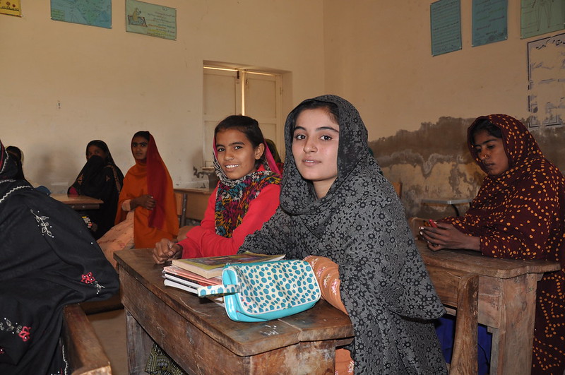 Qubra, a 13-year-old Pakistani girl, was forced to become a child bride because of “her father’s beliefs.” In an interview with VOA News, she revealed, “My father believed that it was sinful for a daughter to remain unwedded once she reached puberty.” According to data from a 2017-2018 survey,
  It is no secret that the issues associated with global poverty were only made worse during the COVID-19 Pandemic. Factors such as the cost of living, food security, healthcare and education are all points of concern for many nations with a struggling poor population. Luckily, there are many organizations working to address these issues. The Zakat Foundation has recently begun working with the United Nations to address worldwide hunger and global poverty.
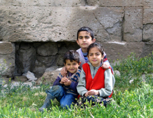 The relationship between the United States and Turkey
 Small island nations possess a unique perspective in the fight against poverty. Representing some of the most vulnerable areas, their tiny landmasses and isolated locations make them particularly susceptible to climate disasters. This can lead to extreme suffering and hardship for the county’s citizens when their supply routes are cut. The
  A new study from the
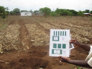 In high-rise corporate buildings and individual cubicles, a barrier unfolds in the lives of many people who work in air-conditioned offices toward the difficulties of a career in agriculture. Small changes in the weather or environmental conditions impact entire communities. The emergence of the collaboration between new, innovative technological solutions and the farms of Malawi shed light on the future of farming.
 Recently, the government of the Democratic Republic of Congo (DRC) decided to auction 30 oil and gas drilling blocks in the Congo Basin forest, including areas that venture into the Virunga National Park. This decision comes just eight months after the government signed a $500 million deal to protect the basin, resulting in protests from local inhabitants and international communities. The President claims that the Congo’s oil auction is necessary for alleviating the DRC’s extreme poverty, but activists argue that the environmental impact of drilling far outweighs the benefits.