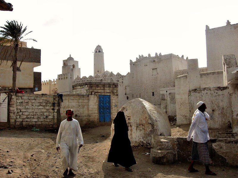
Posts

Satellite Internet in Remote AreasSeveral developing countries have proposed new forms of low-cost satellite internet to connect remote areas. Several up-and-coming organizations include “Starlink” and “Amazon Project Kuiper.”

Starlink and Project Kuiper: Bridging the Digital Divide

SpaceX operates Starlink and “utilizes a constellation of low-Earth orbit satellites to provide service worldwide.” It is designed to deliver “faster speeds and lower latency.” Its key purpose is to provide satellite internet to remote areas where accessibility is a constant barrier to connectivity.

While the operation seems promising, it is at a higher price than other rural internet providers due to the required purchase or lease of proprietary equipment. Another drawback is that the service tends to be affected by extreme weather conditions, common in remote areas with unpredictable climates.

Amazon Project Kuiper is an upcoming satellite internet service that provides high-speed internet to remote and underserved areas. Amazon plans to provide “widespread coverage which includes hard-to-reach rural communities.” However, prices are not yet available to the public, making it difficult to assess the potential success of this new project. Despite this uncertainty, it is expected to be competitive with other satellite internet providers.

Benefits of Satellites

Unlike most other satellite services, there is no required reliance on telephone lines. Amazon plans to “deploy thousands of satellites in low-Earth orbit linked to a global network of antennas, fiber and internet connection points.” These satellites orbit closer to Earth than traditional ones, reducing signal delay and improving speed. The satellites will communicate with a network of ground stations, including antennas, fiber-optic cables and internet hubs, that connect to the broader internet.

Satellites beam data to and from user terminals (like dishes or receivers) and route it through ground infrastructure to reach the internet. Unlike older satellite services, this enables Amazon to provide broadband access in rural, underserved regions without phone lines.

Amazon Project Kuiper plans to “bridge a digital divide” and offer direct support, such as customer service, to ensure technology integration. Although the performance metrics are not yet known until actual deployment, Amazon’s inclusion of a direct support team appears promising.

GSMA: Driving Mobile Innovation

GMSA is a global organization unifying the mobile ecosystem to provide innovative solutions for businesses and to encourage societal change. Its vision is to “unlock the full power of connectivity so that people, industry and society thrive.” It shapes mobile-related policies, supports technology that keeps mobile networks running and creates significant events to target global problems. Events such as MWC and M360 mobilize mobile industry leaders to share ideas and collaborate.

Millions of people depend on connectivity for their livelihoods and basic needs. “In 2022, 36 countries with the largest mobile coverage gap hosted 46% of internally displaced people and 18% of refugees.” Low-cost satellite services could be the answer to target the weaker areas of infrastructure in developing countries, particularly in health care, education and humanitarian protection.

Connectivity for Refugees Initiative

However, there are barriers to usage due to “lack of affordability of devices and data, lack of literacy and language or social barriers.” Due to this accessibility problem, a coalition of organizations and governments, including the UNHCR, International Telecommunication Union (ITU), GSMA and the Government of Luxembourg, created the Connectivity for Refugees initiative in 2023.

The initiative aims to connect 20 million displaced people and their hosts by 2030, helping them stay connected, access global services and build a livelihood. It will involve the private sector, governments, international organizations and forcibly displaced communities to ensure connectivity in underserved areas. Consequently, this will “open pathways for greater access to information, education and livelihoods and enhanced humanitarian protection.” 

Connecting Rwanda

The Rwandan government has created the Kigali Innovation City initiative, focusing on “expanding connectivity” through government-led efforts to “develop robust digital infrastructure and initiatives.”

According to GSMA research, “MTN Rwanda has the widest network coverage in the country, with coverage available in remote areas and refugee camps.” Mobile phones are widely used in Rwanda, with “31% of the population reported to be using a mobile money account.”

There are four active mobile money services in operation: MTN Mobile Money, Airtel Tigo, Dau Pesa and MCash. Through a partnership with KCB Bank, MTN Mobile Money users can access loans and savings products. This partnership also provides additional benefits, including access to health care and educational platforms.

In addition, NGOs such as UNHCR and the U.N. Refugee Agency are supporting connectivity projects in refugee camps like Mahama and Kiziba. These projects establish “community centers with internet access, mobile charging stations, digital literacy programmes and solar power solutions,” helping expand digital access in underserved communities.

Low-cost satellite connectivity is not just access; it’s a lifeline for resilience and opportunity.

– Gabriela E Silva

Gabriela is based in Surrey, UK and focuses on Technology and Solutions for The Borgen Project.

Photo: Pixabay

Cyclones in madagascarMadagascar, the world’s fourth-largest island, is a nation of vibrant cultures and unparalleled biodiversity. Yet beneath this rich surface lies a persistent dilemma: how to escape the cycle of poverty compounded by frequent and destructive cyclones in Madagascar. Strategically located in the Southwest Indian Ocean, Madagascar is among the 10 countries most exposed to cyclones, experiencing about two major storms annually.

These extreme weather events devastate lives, livelihoods and infrastructure, driving vulnerable communities further into destitution. More than 80% of Madagascar’s population lives in poverty, heavily reliant on rain-fed agriculture and thus acutely exposed to climate shocks. When cyclones strike, homes built with weak, cheap materials are easily destroyed. Farmlands flood, leading to food insecurity and rising prices. Damaged roads hinder access to markets, schools and health care. Families lose assets, children are pulled from school and human capital erodes.

Madagascar’s large informal sector, employing more than 80% of the workforce, is particularly vulnerable, with job losses plunging households into debt. To combat this, five cyclone resilience strategies are vital. These measures protect against climate shocks, foster long-term development and reduce poverty.

Averting Immediate Poverty Shocks

Early warning systems give communities time to prepare, evacuate and protect valuables, often determining whether families can recover or are pushed further into poverty.

  • Community-Based Networks. The United Nations Office for Disaster Risk Reduction (UNDRR) emphasizes involving communities in designing early warning systems. Training local volunteers, setting up focal points and using various communication channels, megaphones, radios, SMS and social media, ensures even remote areas get timely alerts. The International Federation of Red Cross and Red Crescent Societies (IFRC) helps strengthen these grassroots systems.
  • Technological Advancement and Accessibility. Satellite data, automated weather stations and partnerships with international agencies like Meteo-France and the World Meteorological Organization (WMO) improve forecast accuracy. Information has to be accessible across literacy levels and languages, offering clear, actionable steps. The African Development Bank’s ADRiFi program has installed weather stations to support preparedness in Madagascar.

Investing in Climate-Resilient Infrastructure

Cyclones consistently destroy infrastructure, cutting off communities, disrupting supply chains and stalling recovery. Investing in resilient infrastructure ensures continuity and reduces poverty impacts.

  • Build Back Safer Principles. Reconstruction should prioritize cyclone-resistant designs, like reinforced concrete, elevated foundations and durable roofs. The Shelter Cluster promotes “Build Back Safer” (BBS) strategies, including cash-for-shelter programs, so families rebuild stronger homes.
  • Critical Transport Networks. Roads and bridges are vital for trade, aid and recovery. Damaged infrastructure drives up food prices and deepens hardship. The World Bank’s Connecting Madagascar for Inclusive Growth Project (PCMCI) is expanding resilient transport systems and deploying modular bridges for emergencies.
  • Community Hubs as Shelters. Resilient schools and clinics can double as emergency shelters, preserving access to vital services. Caritas Madagascar helps repair such facilities, maintaining continuity in education and health care. ADRiFi has also supported classroom reconstruction and long-term human development.

Broadening Pathways Out of Poverty

Overdependence on subsistence agriculture makes communities highly vulnerable. Diversified livelihoods create buffers against crop failures and storm disruptions.

  • Climate-Smart Agriculture. Promoting flood- and drought-resistant crops, better irrigation and sustainable techniques enhances food security. The World Food Programme (WFP) supports projects like dam construction and climate-resilient farming to reduce vulnerability in Madagascar.
  • Nonfarm Income Generation. Vocational training in carpentry, masonry, crafts and small business management creates jobs beyond farming. Microfinance, especially for women, fosters entrepreneurship, offering income when crops fail.
  • Sustainable Fisheries and Aquaculture. Coastal communities can benefit from resilient fisheries, provided sustainable practices are used. Protecting marine ecosystems ensures fish populations endure cyclone disruptions.

Safeguarding Crucial Ecosystems

Ecosystems like forests and reefs act as natural buffers against cyclones. However, environmental degradation, often poverty-driven, removes these protections.

  • Reforestation and Afforestation. Mangroves and coastal forests reduce wind and water damage, protecting homes and farmland. Eden Reforestation Projects has planted millions of trees in Madagascar, linking environmental restoration with local employment. Community conservation groups like Mitsinjo promote sustainable land use and forest stewardship.
  • Wetland Restoration. Wetlands absorb floodwaters and filter pollutants, helping prevent disease. In Vatomandry, a town in Madagascar, an integrated landscape approach combines drainage and wetland restoration to reduce cyclone risks.

Reinforcing Social Safety Nets

Even with strong prevention measures, cyclones in Madagascar will continue. Social safety nets are essential to protect the most vulnerable and speed recovery.

  • Contingency Funds and Insurance. Madagascar has joined the African Risk Capacity (ARC) insurance program and created a National Contingency Fund, allowing fast access to recovery funds and reducing reliance on delayed aid.
  • Cash Transfers and Food Assistance. These directly support households post-disaster, allowing families to meet basic needs and avoid harmful coping strategies. The World Bank’s Safety Nets and Resilience Project supports targeted assistance. WFP provides emergency food aid and nutrition support, especially for children.
  • Community Networks and Microinsurance. Local disaster committees and informal support systems help direct aid where needed. Microinsurance for small farmers and informal workers provides a safety net, enabling recovery without deepening debt. CARE Madagascar works on community-driven disaster risk reduction.

A Sustainable Future

Madagascar’s fight against poverty cannot be separated from its climate vulnerability. Cyclones in Madagascar continually erase development gains. But by strengthening early warning systems, infrastructure, livelihoods, ecosystems and social protection, Madagascar can build resilience and chart a path to long-term prosperity. These strategies, rooted in community engagement and sustainability, offer a chance to break the cycle of poverty and forge a future where the nation survives storms and thrives beyond them.

– Anoushka Rai

Anoushka is based in Frisco, TX, USA and focuses on Good News and Technology for The Borgen Project.

Photo: Flickr

Satellite Technology Combating Yemen’s Drought Crisis Years of conflict in Yemen have destroyed vital infrastructure, leaving 20.7 million people in need of humanitarian aid, including 15 million without reliable access to clean water. The severity of these conditions has raised the demand for innovative solutions such as satellite technology.

Satellite technology sparks hope as a pivotal tool in transforming humanitarian disasters, enabling remote sensing to monitor, assess and respond to water scarcity. It creates access to clean water through satellites capturing vital data on rainfall patterns, soil moisture and land use, providing updated insights in a country with limited on-the-ground access. Thus, integrating satellite technology to combat Yemen’s drought crisis could lay the groundwork for long-term resilience in one of the world’s most water-insecure regions. 

Yemen’s Ongoing Water Shortage

Yemen faces one of the most severe water crises worldwide, with groundwater depletion occurring at twice the natural recharge rate. The cultivation of Qat, which consumes more than 40% of the country’s renewable water resources and 32% of all groundwater withdrawals, is a major driver of the depletion. Nearly 17.8 million people lack access to safe water and adequate sanitation services. Conversely, the national water network reaches less than 30% of the population, forcing many, especially women and children, to walk long distances only to fetch water. Overall, this scarcity has triggered major health crises, including the worst cholera outbreak in modern history, with more than 2.5 million reported cases and at least 4,000 deaths since 2016.

The ongoing conflict and political instability have further exacerbated water access and management, as infrastructure deteriorates and institutional oversight weakens, aggravating the crisis of water scarcity and aridity. The International Committee of the Red Cross has responded to this issue by rehabilitating boreholes and water stations, allocating chlorine tablets and supplying more than 3 million liters of water with 17 generators to prisons, hospitals and water projects to help reduce waterborne disease outbreaks. Despite these critical interventions, the continuous droughts highlight a growing humanitarian call for global concern driven by environmental, social and political challenges that demand urgent, coordinated action through satellite technology to combat Yemen’s drought crisis.

Remote Sensing Water Displacement

Advancements in satellite technology are revolutionizing Yemen’s approach to managing its prolonged water crisis. With nearly 80% of the population requiring humanitarian aid, traditional methods of monitoring groundwater levels have become increasingly challenging due to ongoing conflict and infrastructure degradation. Remote sensing tools, such as the Surface Energy Balance Algorithm for Land, have been pivotal in providing high-resolution data on evapotranspiration and irrigated areas, offering a comprehensive understanding of water usage. For instance, the Groundwater and Soil Conservation Project, founded in 2009, initiated implementing the use of satellite imagery to assess crop water consumption in areas such as Siham, Abiyan, Dhamar and Rada.

 The findings revealed that single-season crops, which constitute 76% of irrigated land, have a significantly higher evapotranspiration rate compared to rainfed crops, highlighting areas where water conservation efforts can be most effective. This data-driven technique, derived from the integration of satellite-based systems, enables real-time monitoring of groundwater recharge and abstraction rates, facilitating the identification of regions most at risk of depletion. This approach empowers local authorities and humanitarian agencies to plan targeted interventions, such as promoting water-efficient irrigation techniques and sustainable crop selection.

NGO Satellite Solutions

A consortium led by HR Wallingford is deploying an advanced satellite-based system to monitor Yemen’s groundwater remotely. Using data on rainfall and cropland, the system estimates groundwater recharge and usage in real-time, providing pivotal information to nongovernmental organizations (NGOs) amid limited ground access due to conflict.

This technology overcomes traditional monitoring challenges by enabling continuous tracking of aquifer depletion and forecasting future water availability under climate change scenarios. It supports preventive measures such as early detection of shortages and promoting efficient irrigation and crop management to reduce water stress. NGOs utilize this data to target vulnerable communities, coordinate relief efforts and implement on-the-ground conservation programs.

By offering transparent, scalable monitoring, the system fosters collaboration between NGOs and international partners, enhancing Yemen’s capacity to manage its severe drought crisis effectively and ensure a more ecologically balanced future. 

What’s Next?

By providing a comprehensive and up-to-date overview of water resources, satellite technology plays a crucial role in mitigating the impacts of Yemen’s water crisis and steering the nation toward a more sustainable future.

– Hibah Iqbal

Hibah is based in Houston, TX, USA and focuses on Global Health for The Borgen Project.

Photo: Flickr