Mapping Startup Helps Identify Unmapped Areas
 In spite of modern digital services like Google Street View, many locations in developing countries, such as Dar es Salaam in Tanzania, remain inaccessible to much of the world.
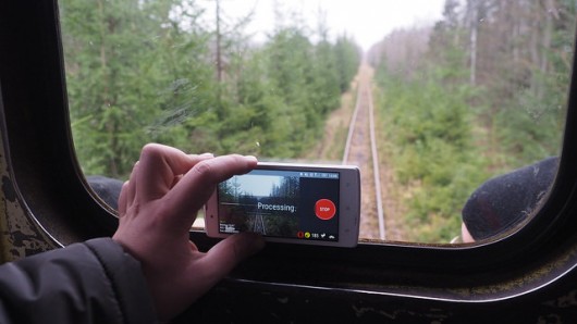
Swedish startup Mapillary and the World Bank have teamed up to solve this problem. Mapillary enables individuals to map their own streets by collecting street level photos simply by using their smartphones.
Such maps can help cities anticipate and recover from natural disasters, track traffic congestion, distribute resources to the impoverished communities that need them and build public transportation systems.
Mapillary CEO Jan Erik Solem told NPR News, “Dar es Salaam has really poor map data. The reason is that the mapping companies need people on the ground or in the local area to create the actual map.”
Maps that detail roads, homes, rivers and terrain may help kickstart city planning.
“In order for it to flourish into the metropolitan city [Dar es Salaam] has the potential to become, we began a community-based mapping project called Dar Ramani Huria (Swahili for “Dar Open Map”),” states a blog post from the World Bank, “to bring disaster prevention and response to previously unmapped areas, training the local community to create highly-accurate maps by the residents who know their city best.”
25 wards have been charted so far in Dar es Salaam with Mapillary. The task was accomplished by attaching a camera to a local Tanzanian rickshaw and by using photos taken by a motorist. These photos were then uploaded to Mapillary and constructed in 3D. A blog post by the World Bank on Mapillary’s website says that this information allows them to “pinpoint troubled areas” and to map out the routes locals often use.
As these maps are developed, they are run through software that develops natural disaster scenarios to help citizens improve planning and preventive efforts.
NPR reports that more than 260 citizens have volunteered to take photos for the mapping project. Locals have taken around 23,000 photos, which will map 300 miles of road.
“Sparking the community’s interest in mapping has the potential to truly transform Dar es Salaam into a prosperous city with the infrastructure to prevent floods, bring awareness to the need for flood prevention and risk reduction, and arm its citizens with the right tools and skills to build a better city,” states the same blog post.
– Kaitlyn Arford
