GIS: The Universal Language of Development
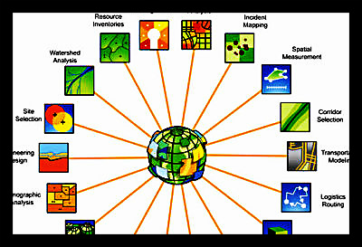
If a picture is worth a thousand words, a custom-tailored map which can be manipulated to display the interactions between multiple selected variables must be worth entire books. Geographic Information Systems (GIS) provides this power to the user who understand the language of the software, and this power is especially important to development and aid organizations seeking to maximize their impact.
Unlike conventional cartography, GIS software can exploit social, economic, political, and environmental data to create an image which can then be layered onto the topographic landscape in any way the user desires. The relations between layers, and between data within layers, can then be presented to the viewer in a way that draws attention to the important facts.
This differs fundamentally from the report by presenting information visually, without losing depth in the way that a chart or graph flattens the ethnographic depth of the actual survey informing it.
Geospatial analysis has been used primarily for military purposes in the past, but that situation is already evolving. USAID is deploying geo-analysts in almost every program to give its staff the most useful information possible, going so far as to institute its own geospatial arm, to ensure the best possible use of the existing technology. The United Nations is on a similar path.
A software which was once esoteric and difficult to manage – akin to prototypical PC operating systems – has been streamlined and aestheticized so that with less than a year’s training, anyone can masterfully manage multiple databases with thousands of streams of data into coherent maps.
As with any form of communication and representation, there is a danger of misrepresentation and error. Factors can be ignored or manipulated to produce maps that do not mirror reality, or that fail to bring attention to critical factors. Even if the map is sound, it can still be misused by those with ulterior motives or simple incompetence.
As with all analysis, GIS relies entirely on a substrate of reliable data from which to extrapolate conclusions. Unlike polls, however, GIS data does not require a ‘boots on the ground’ approach – though this can be useful. For many applications, remote sensing, satellite imagery, and tomography are sufficient, meaning that, in many situations, the difficulties of other analytical approaches are evaded.
What is more, with cloud computing becoming nearly universal, a global GIS network, shared by all development agencies, would perpetuate a system whereby an up-to-date cartographic representation of reality would be accessible to those seeking to capitalize on its wealth of information, thereby bridging the gap between those who are able and willing to help – but lack an idea of where to begin or what needs doing – and those who require assistance. GIS transcends language barriers, enabling global cooperation and understanding to tackle pressing issues. In that way, GIS is becoming the universal language of development.
– Alex Pusateri
Sources: Directions Mag, Esri
